
Some of the content on this website resource is still in development.
If you have any questions or comments please email: [email protected]
If you have any questions or comments please email: [email protected]
CooeeVic
An Australian Journey
What is it about
- This is a RESOURCE for self guided walking or cycling with an overall distance of approximately 450km.
- Where possible, the suggested routes follow existing walking and cycling trails, suburban streets, quiet country roads and some forest tracks.
- The route is chosen, based in the first instance, on accommodation availability, with a distance of 20-30km apart. If you don't want to tackle the whole thing at once, each of the four (4) sections can be completed in under a week on foot. Selecting and booking accommodation will determine final route and distances between stops.
- Printable passport to record your journey. (See About page)
- Bookable accommodation so no need to carry a large pack.
- Explore and learn about indigenous culture along the way.
- Before commencing the walk it is essential to read the safety information on the Safety page on this site.
- If cycling the route it is suggested undertaking it in reverse to take advantage of the most common prevailing westerly wind. There are several trains per day from Melbourne to Warrnambool, Visit the PTV website for timetable. The Ride with GPS cycle maps have been done in reverse from Warrnambool to Melbourne using Ride with GPS and are available in digital form using the APP.
Although the developer of this resource has no indigenous heritage this material has been compiled with the intention of recognising the lands of the Traditional Owners from the Boonwurrung, Wathaurung, Gadabanud and Gulidjan peoples. It is intended to respectfully acknowledge the Aboriginal land that is an integral part of the walkers/cyclists journey. All references have been established using material readily available through the internet or texts but should any of the material or terminology be considered incorrect, inadequate or disrespectful, we would appreciate feedback so changes can be made as appropriate: additions, deletions, corrections will be welcomed.
From the Koori Heritage Trust in Federation Square, Melbourne, to Tower Hill (near Warrnambool). The path is not waymarked but as the route has been established using Google Maps as all maps being downloadable and can be used on mobile phones or tablets. If a hard copy is preferred the detailed Google notes are available in printable PDF format. A link to these PDF's is provided on each of the Section pages of this site. However, in choosing which mapping option you will use, be aware that internet access can be inconsistent and unreliable in some regions of Victoria.
Whilst the route has been established with the major focus on walking, a cycling alternative has been provided and this has been created using Ride with GPS. The cycling version follows, where possible, trails, tracks and quiet roads but in some instances it is necessary to include roads that carry traffic. Printable PDF directions are also included.
Before contemplating undertaking part or all of this route it is essential that you read the information on the About page of this website, and particularly the Safety Information located here.
|
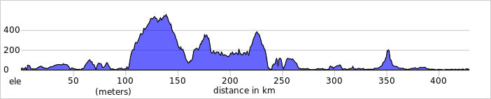
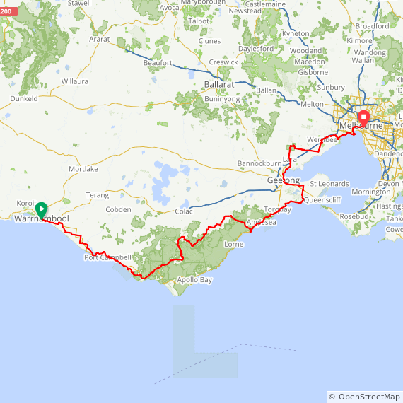
RidewithGPS map from Warrnambool to Melbourne.
|
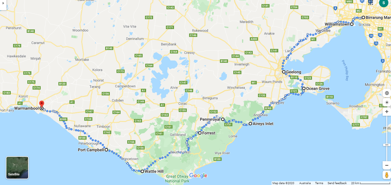
Federation Square (Melbourne Koori Heritage Trust) to Williamstown - 17km; Williamstown to Werribee 25km; Werribee to Little River - 26km; Little River to Lara - 17km; Lara to Geelong - 20km. |
Geelong to Ocean Grove - 27km; Ocean Grove to Torquay - 25km; Torquay to Aireys Inlet (via Anglesea) - 40km. |
Aireys Inlet to Pennyroyal 24km; Pennyroyal to Forrest - 24km; Forrest to Gellibrand - 24km; Gellibrand to Lavers Hill (via Beech Forest) - 34km; Lavers Hill to Wattle Hill - 25km; Wattle Hill to Princetown - 15km. |
Princetown to Port Campbell - 18km; Port Campbell to Peterborough - 12km; Peterborough to Nirranda - 20km; Nirranda (Butterfly Farm) to Allansford - 26km; Allansford to Warrnambool - 12km; Warrnambool to Tower Hill - 18km. |
The Kulin nation is an alliance of five Indigenous Australian tribes in south central Victoria. Their collective territory extends around Port Phillip and Western Port Bays and, up into the Great dividing range and the Loddon and Goulburn River valleys. Fishing, hunting and gathering, they made a sustainable living from the rich food sources of Port Phillip and the surrounding grasslands. Before colonisation they spoke 5 related languages. Wathaurong tribes of the Kulin nation spoke one of these languages and it is their country we walk through for the majority of this walk.
After Aireys Inlet we enter Gadabanud and Gulidjan country.
https://www.aboriginalheritagecouncil.vic.gov.au/wathaurung-aboriginal-corporation
After Aireys Inlet we enter Gadabanud and Gulidjan country.
https://www.aboriginalheritagecouncil.vic.gov.au/wathaurung-aboriginal-corporation
