Section 4 (6 days)
Princetown to Tower Hill 110km
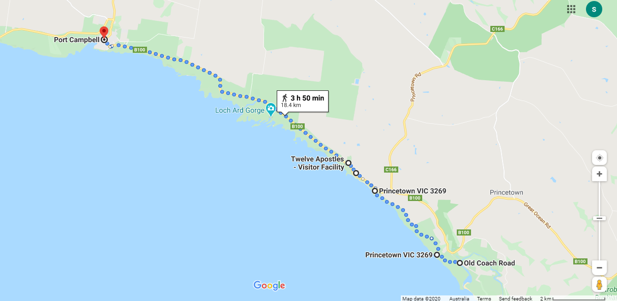
Princetown to Port Campbell 18km
Terrain: Spectacular clifftop walking with access points into some beaches. From Princetown to the Twelve Apostles Visitor Centre it is the final stage of the Great Ocean Walk and reasonably flat. After the 12 Apostles Visitor Centre there are no walking tracks, so it will be necessary to walk the Great Ocean Road for about 11km. There is little to no verge but generally a wide grassy area beside the pavement with very high visibility. West of the Visitors Centre the road is not as busy as the sections east of the Visitor Centre. But caution still needs to be taken.
Shorten: There is a bus from the 12 Apostles Visitor Centre to Port Campbell, Monday, Wednesday and Friday at 2.30pm.
Cycling: It is not possible to cycle the GOW in this section so it will be necessary to follow the busy Great Ocean Road which has little to no verge. In this part, however, the road is very open with excellent visibility and it is flat and fairly straight. Make sure you detour to visit the designated viewing points along the way.
Click here to download detailed directions (PDF)

From Princetown
|
To Port Campbell
(74m-2m) |
Points of interest:
Views: Over the ocean for miles.
Small coastal village of Port Campbell.
Landmarks: 12 Apostles, Loch Ard Gorge, Mutton Bird Lookout, Thunder Cave and the whole spectacular coastline.
12 Apostles Visitor Centre: Take a helicopter ride to see the coastline from the air. Historic shipwreck display.
Great Ocean Road Wildlife Park in Princetown: Australian wildlife sanctuary.
Click here to find out what facilities and accommodation are available in the towns.
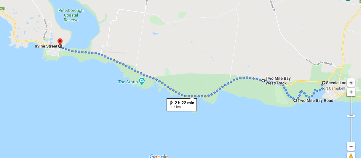
Port Campbell to Peterborough 12km
Terrain: Flat, open road with big sky and high visibility. Follow the beach, traversing the river mouth and up the steps to the Port Campbell Discovery Trail heading west out of Port Campbell. Then, unfortunately it is the Great Ocean Road again! (It has a wide grassy verge and high visibility so not too bad.) It is certainly worthwhile to take all the detours into the lookouts and landmarks along the way.
Cycling: It is not possible to cycle the Port Campbell Discovery Trail, so take the Great Ocean Road out of Port Campbell.
Shorten: The public transport options are limited. One bus per week on Thursday departing from the surf club in Tregea Street at 9.20am. Contact Ride with Us Mob:0438 407 777 as they offer all types of pick up services in the region. https://www.ridewithus.com.au/
Click here to download detailed directions (PDF)

From Port Campbell
|
To Peterborough
(71m-4m) |
Points of interest:
Spectacular coastline
Landmarks: The Grotto, London Bridge, The Arch.
Spectacular coastline
Landmarks: The Grotto, London Bridge, The Arch.
Click here to find out what facilities and accommodation are available in the towns.
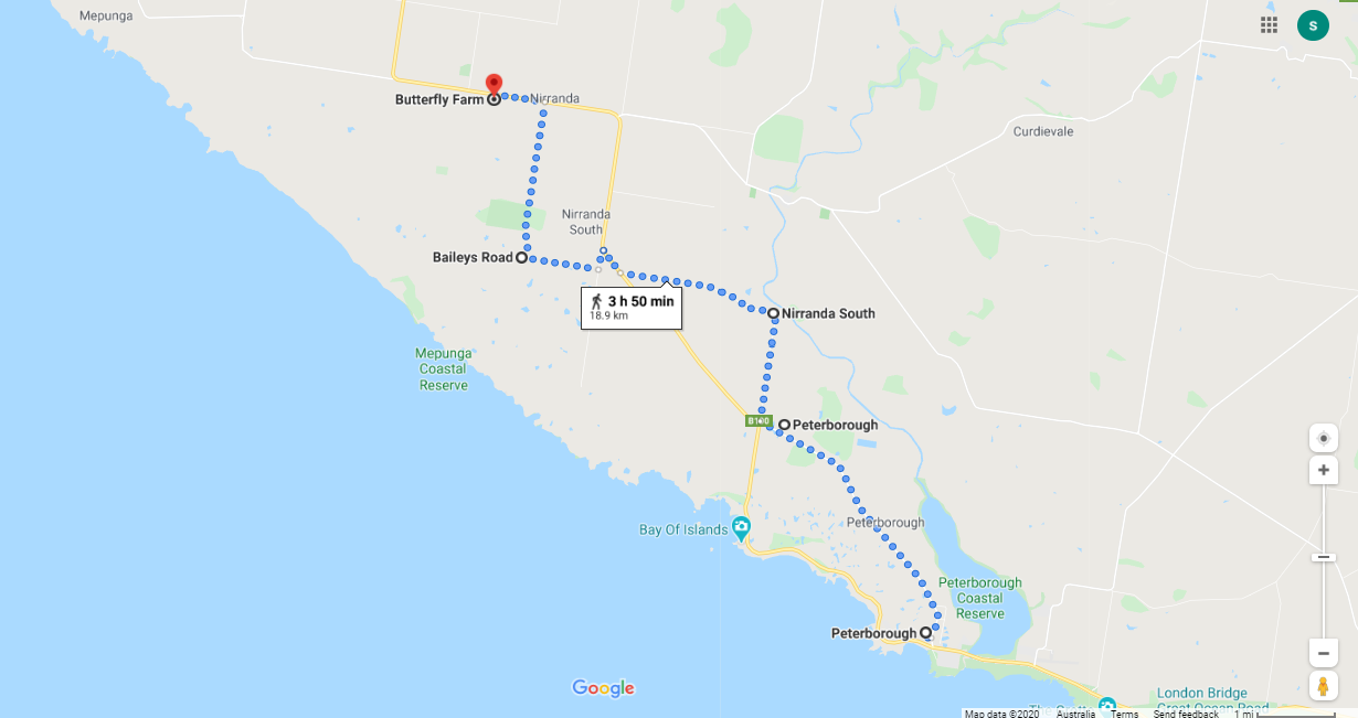
Peterborough to Nirranda 20km
Terrain: Flat agricultural land without much shelter. Away from the coast for a while through open grazing land again. No services and only one option for accommodation at Butterfly farm. It will be necessary to carry food for dinner for this section or pre-arrange with your accommodation.
Shorten: Pubic transport options are limited in the region. Visit PTV website to find out times for the once a week Thursday bus.
Cycling: Follow the route indicated. A worthwhile detour is to the Bay of Islands
Click here to download detailed directions (PDF)
Shorten: Pubic transport options are limited in the region. Visit PTV website to find out times for the once a week Thursday bus.
- Taxi service in Warrnambool. Ph.131008.
- Contact Ride with Us Mob:0438 407 777 as they offer all types of pick up services in the region. https://www.ridewithus.com.au/
Cycling: Follow the route indicated. A worthwhile detour is to the Bay of Islands
Click here to download detailed directions (PDF)

From Peterborough
|
To Nirranda
(57m-5m) |
Points of interest:
Not a huge amount in this stretch, just open farmland.
Not a huge amount in this stretch, just open farmland.
Click here to find out what facilities and accommodation are available in the towns.
Nirranda to Allansford 26km
Terrain: Flat agricultural land without much shelter.
Shorten: No public transport options but a taxi service in Warrnambool. Ph.131008. Or talk to your accommodation provider.
Cycling: Follow the route indicated.
Click here to download detailed directions (PDF)
Shorten: No public transport options but a taxi service in Warrnambool. Ph.131008. Or talk to your accommodation provider.
Cycling: Follow the route indicated.
Click here to download detailed directions (PDF)

From Nerranda
|
To Allansford
(53m-10m) |
Points of interest:
Shipwreck coast: Glimpses of this stunning coastline.
The Hopkins River: The Hopkins River starts in Ararat, and flows generally south, joined by twelve tributaries before reaching its mouth into Bass Strait at Warrnambool.
Cheesworld at Allansford: Owned and operated by the Warrnambool Cheese & Butter Factory, Cheese World is the cellar door outlet for their award winning Warrnambool Heritage Cheddar cheese range..
Click here to find out what facilities and accommodation are available in the towns.
Allansford to Warrnambool 15km
The word "Warrnambool" originates from the local Aboriginal Australian people, the Koroitgundidj, as the name for a nearby volcanic cone, now known as Tower Hill. It has been interpreted to mean "two swamps" or "ample water". Wikipedia
The Gunditjmara people are traditional owners of the coastal area extending from Portland in the south, Port Fairy, Warrnambool and inland into Camperdown. Gunditjmara people are traditionally river and lake people with Budj Bim, Framlingham Forrest, Lake Condah and the surrounding river systems being of great cultural significance and importance historically, economically and spiritually. Gunditjmara means ‘belonging to person’ and the Gunditjmara Nation shares its borders to the west with the Buandig people, to the north with the Jardiwadjali and Djab Wurrung peoples, and to the east with the Kirrae Whurrong. Our Nation’s totem is “Bunjil” the Eagle. https://www.gunditjmara.org.au/about-us
Terrain: Some flat grasslands heading towards the coast and the whale watching area, across the Hopkins River and along the foreshore reserve.
Shorten: No public transport options but a taxi service in Warrnambool. Ph.131008. Or talk to your accommodation provider.
Cycling: Follow the route indicated.
Click here to download detailed directions (PDF)
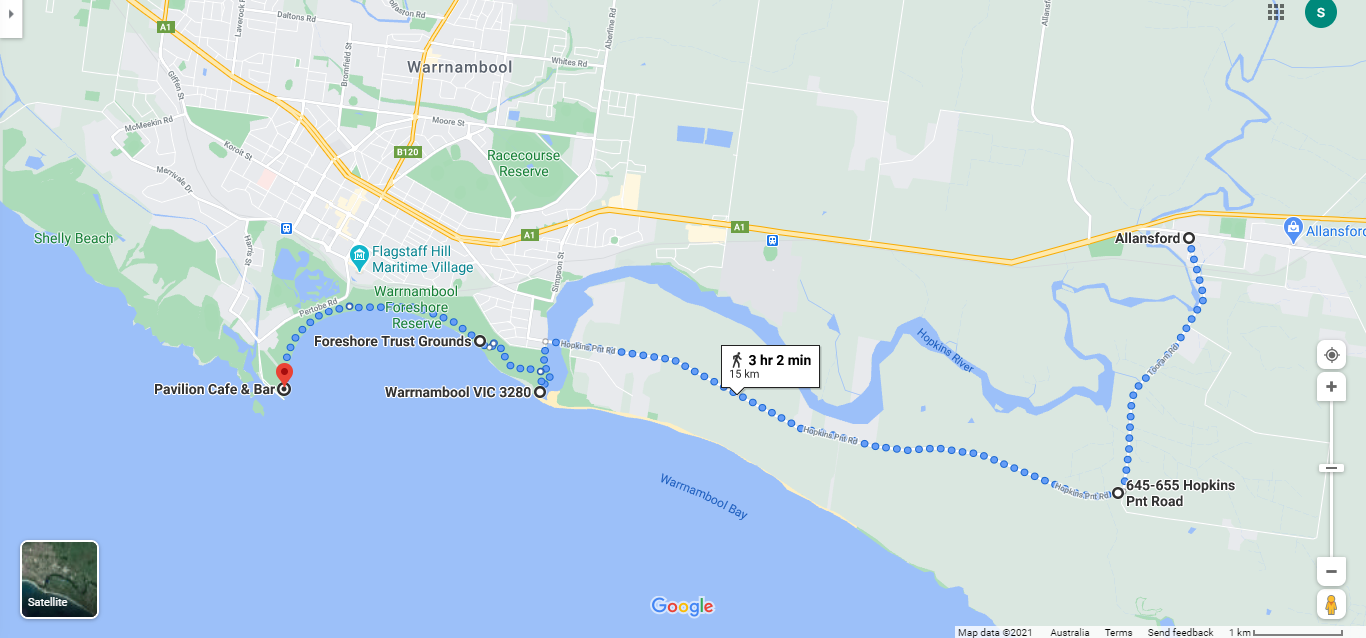

From Allansford
|
To Warrnambool
(47m-4m) |
Points of interest:
Bushland and open farm country: .
Flagstaff Hill Maritime Museum and Village: Flagstaff Hill is a state heritage listed site that can be explored to gain a glimpse into the regions maritime heritage.
Whale watching: From the platforms on the beach.
Moyjil Point Ritchie: (at the mouth of the Hopkins River) For thousands of years Aboriginal people visited the area to gather food including eels from the Hopkins River and shellfish from the ocean. A record of this extended period of human occupation is preserved in the rocks and in the sand dunes of Point Ritchie-Moyjil.The indigenous community and scientists have been working together to help tell the story of this site which is recognised as having great heritage significance. http://www.moyjil.com.au/culture
Click here to find out what facilities and accommodation are available in the towns.
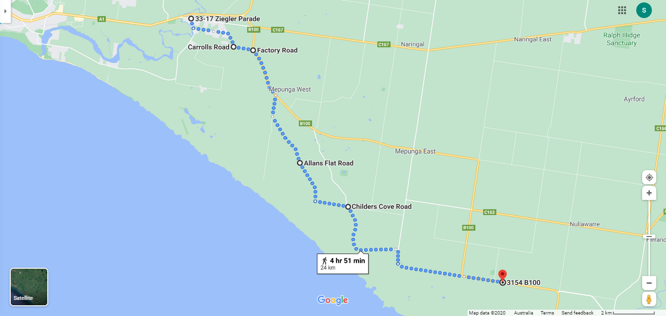
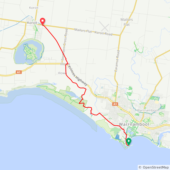
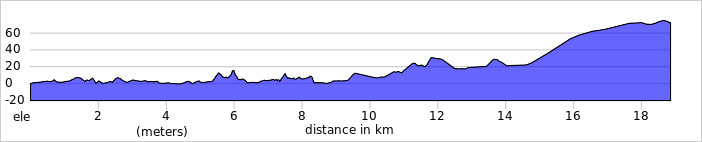
Warrnambool to Tower Hill/Koroit 19km
Terrain: The largest part of this section is on the Port Fairy to Warrnambool Rail Trail then up to the top of Tower Hill. There are some accommodation options near Tower Hill, otherwise visit the quaint rural village of Koroit. The rail trail winds its way through the back of the sand dunes and out towards Koroit through agricultural land.
The trail commences at the Warrnambool promenade and continues to Koroit. Visit the website for more information http://www.portfairytowarrnamboolrailtrail.com.au/. The rail trail is identified as Port Fairy to Warrnambool and there are some areas where signage is limited, so take care as this route is in the opposite direction. The Rail trail is not available using Google maps so there is no downloadable map for this section but a RideWithGPS map of the full route has been provided, or visit the Rail Trails Australia website and download a PDF map from there. https://www.railtrails.org.au/trail?view=trail&id=160
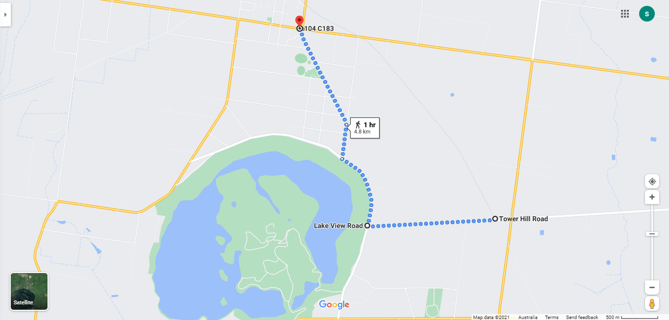
Tower Hill Note: The rail trail does not go through Tower Hill so if planning a visit to Tower Hill a detour map from the trail is provided below. This is a Google map and is downloadable. The views into the crater are spectacular, but if you want to visit the Wildlife Reserve on the central island it will be necessary to head south west along Lake View Road as a separate extension of approximately 6-8km return.
Shorten: No.8 bus from BP Service Station to Koroit about 8 per day.
Cycling: Follow route indicated.
Koroit is an abbreviation and simplification of the name of the Aboriginal people who lived in the area and were known as the Koroitch Gundidj. https://www.aussietowns.com.au/
The trail commences at the Warrnambool promenade and continues to Koroit. Visit the website for more information http://www.portfairytowarrnamboolrailtrail.com.au/. The rail trail is identified as Port Fairy to Warrnambool and there are some areas where signage is limited, so take care as this route is in the opposite direction. The Rail trail is not available using Google maps so there is no downloadable map for this section but a RideWithGPS map of the full route has been provided, or visit the Rail Trails Australia website and download a PDF map from there. https://www.railtrails.org.au/trail?view=trail&id=160
Tower Hill Note: The rail trail does not go through Tower Hill so if planning a visit to Tower Hill a detour map from the trail is provided below. This is a Google map and is downloadable. The views into the crater are spectacular, but if you want to visit the Wildlife Reserve on the central island it will be necessary to head south west along Lake View Road as a separate extension of approximately 6-8km return.
Shorten: No.8 bus from BP Service Station to Koroit about 8 per day.
Cycling: Follow route indicated.
Koroit is an abbreviation and simplification of the name of the Aboriginal people who lived in the area and were known as the Koroitch Gundidj. https://www.aussietowns.com.au/
|
Click here to download detailed directions (PDF)
|
Points of interest:
Tower Hill: An inactive volcano of international and national geological significance with a series of small cones and spheres surrounded by a crater lake. It is now a wildlife reserve.
Tower Hill Visitor Centre: Located in the Tower Hill Wildlife Reserve is run by the Worn Gundidj Cooperative in conjunction with Parks Victoria and runs guided walks in the crater. http://www.towerhill.org.au/index.php
Click here to find out what facilities and accommodation are available in the towns.
Return to Melbourne
From Warrnambool: Take the train to Melbourne (4 per day) with a journey time of about 3.5hrs. https://www.ptv.vic.gov.au/journey
From Koroit: Take the No.8 bus to Warrnambool (about 8 per day) and then the train to Melbourne.
Past Warrnambool
There are no accommodation options within walking distance west or north of Warrnambool so continuing on foot is not possible. However, if you are cycling or choose to hire a car there are a number of options you might choose to explore further:
There are no accommodation options within walking distance west or north of Warrnambool so continuing on foot is not possible. However, if you are cycling or choose to hire a car there are a number of options you might choose to explore further:
- Continue north west for appoximately 80km to Budj Bim National Park. Budj Bim is home to one of the world's oldest aquaculture systems – a 6,600-year-old network of channels, dams and weirs developed by the Gunditjmara people to manipulate flood plains and water flows to trap and harvest kooyang (eels) incorporating Lake Condah ... It's one of the few Australian Indigenous world heritage sites. Visit this website to find out more about this region whc.unesco.org/en/list/1577/
- Travel north to The Grampians to explore the indigenous culture of that region. Known as Gariwerd, the region has been home to the Djab Wurrung and Jardwardjali people for 20,000 years and contains the densest concentration of rock art paintings and the largest assemblage of Aboriginal art motifs in Victoria. Visit this website to find out more about the region. www.visitgrampians.com.au/see-do/culture/indigenous-culture
